
Installs
10,000,000+
Price
Free
Developers
OsmAnd
Content Rating
Everyone
Android Version
7.0
Version
5.2.9
OsmAnd — Maps & GPS Offline APP Review
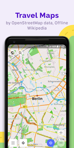
OsmAnd — Maps & GPS Offline is an innovative application designed for offline navigation powered by OpenStreetMap (OSM). Whether you're exploring hiking trails or navigating urban landscapes, this app allows you to plan routes and track your journeys without needing a cell signal. With features tailored to various transportation modes and customizable settings, it sets the stage for a more personalized navigation experience.
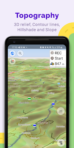
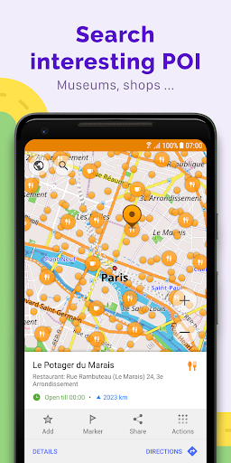
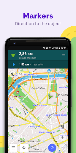
The application brings a plethora of features to its users. You can display various points of interest on the map, such as attractions and restaurants, allowing for an enriched travel experience. The versatile map styles—ranging from touring views to nautical maps—accommodate different activities and preferences, helping you find your way with convenience and flair.
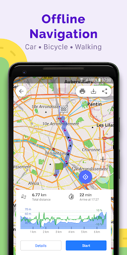
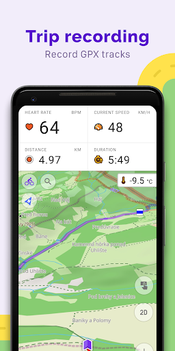
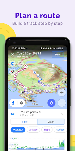
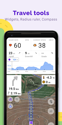
With OsmAnd, even route planning is comprehensive. By recording GPX tracks and visualizing route data such as ascents and descents, users can easily manage their travel plans. The app even supports manual route creation, ensuring that no matter your mode of transportation—be it car, motorcycle, or bicycle—every detail is catered for. Additionally, with an active community around OpenStreetMap, users can contribute to the map data, creating a truly collaborative navigation solution.
Despite its rich feature set, OsmAnd may not be perfect for everyone. Users may experience a learning curve while adapting to its various functionalities, and some features are only accessible through in-app purchases. Still, for those frequently on the move and in need of offline maps that prioritize user privacy, OsmAnd stands out as a remarkable choice.
Latest Update:
• Added street and city details to search results
• New Trip Recording widgets: Max Speed, Average Slope, and improved Uphill/Downhill
• New "Marine" nautical map style with extensive customization options
• Improved map rendering speed
• Enhanced connectivity with OBDII BLE adapters
• Added heart rate metrics to the "Analyze by Interval"
• Added duration display for planned tracks
• Altitude units can now be set separately from distance units
Pros
Cons
Comments
Similar Apps

OOO - Out of Office
Travel & Local
4.5

STAY Hotel App
Travel & Local
3.3

BYHOURS: Hotel Microstays
Travel & Local
3.0

Malaysia Airlines
Travel & Local
4.8

BringFido Pet Friendly Hotels
Travel & Local
4.8

ID90 Travel
Travel & Local
4.8

Cheapflights: Flights & Hotels
Travel & Local
4.8

Hospitality Mobile Access
Travel & Local
3.1

Social Deal - The best deals
Travel & Local
4.2

Global Entry
Travel & Local
4.9

TAP Air Portugal
Travel & Local
2.3

TAP LA
Travel & Local
2.2

Aquatica
Travel & Local
4.8

Adventure Island
Travel & Local
4.8
Trending Apps

Jily -Match to video chat
Social
4.7

CARFAX Car Care App
Auto & Vehicles
4.7

AutoScout24: Automobile market
Auto & Vehicles
4.6

CARFAX - New & Used Cars
Auto & Vehicles
4.6

Device Clone
Productivity
4.0

Android Device Policy
Tools
3.1

Device Care
Tools
3.9

Squadnox - Game Server Hosting
Tools
2.5

SuperToons Masha and the Bear
Entertainment
4.5

Apples & Bananas Kids App
Education
3.4

Codecademy Go
Education
4.7

Learn Python-Code Lab by Ocean
Education
4.2

Hyperskill: Learn to code
Education
4.8

Code Life - Learn to code
Education
4.4

Encode: Learn to Code
Education
4.5

Learn Python
Education
4.8

Business Marketing Auto Reply
Communication
4.4

WooCommerce
Business
4.6

Glitchy Digital Marketing
Social
4.6

Learn Growth Hacking
Education
4.7